

Crohane [An Cruachan]
Good walks are even better shared.
Overview
Exploring Crohane [An Cruachan]
Crohane, affectionately known as An Cruachan, rises to 774 meters, making it a prominent feature in the Kerry Mountains. As you ascend, you'll encounter a delightful mix of rocky terrain and grassy slopes, peppered with patches of bog that remind you you're in the heart of the wild.
Geology
The geology here is as fascinating as it is diverse. Comprising primarily schist and quartzite, Crohane's rocks have been shaped over millions of years, giving the summit its rugged character. The weathered stones tell a rich story of Earth's past—perfect for geology enthusiasts or anyone who loves a good rock collection!
Routes
Start your journey from the Lough Acoose car park where the path is well signposted. The trail winds its way through stunning heather-covered landscapes before leading to the summit. Ensure you wear proper hiking boots to tackle those rocky patches!
Summit Features
At the top, enjoy the impressive stone cairn and a triangulation pillar. These features not only mark your achievement but offer superb spots for photographs. Remember, the mountain doesn’t mind you posing upfront—as long as you share the spectacular backdrop!
Views
Once at the summit, the views are nothing short of breathtaking. You’ll be able to spot the tranquil waters of Lough Acoose and the majestic peaks of the MacGillycuddy's Reeks in the distance. For the best visibility, aim to hike during the spring or early autumn when the scenery is at its most vibrant.
Hazards
While the journey is rewarding, keep an eye out for loose rocks and slippery sections, particularly in wetter conditions. And don’t forget—Mother Nature has a surprising sense of humour; those misty patches can sneak up on you!
Nearby Summits
For the ambitious hiker, nearby peaks such as Cnoc na Peiste (808 meters) and Knockbrack (704 meters) offer additional opportunities for exploration.
Access
Parking is available at Lough Acoose car park, but spaces fill up fast. The approach from the nearest town, Glenbeigh, ensures a warm welcome where you can grab a bite to eat or use the loo post-hike. If public transport is your style, do a bit of research beforehand to navigate your way here.
Facilities
Though there are no facilities on the mountain, Glenbeigh boasts cafes and friendly locals ready to serve the weary hiker a freshly brewed cup of tea—or a pint, if that's your post-hike reward!
History
The name An Cruachan translates to 'the round hill,' resonating well with the shape of the peak. Its cultural significance in local folklore makes it a notable site for stories of ancient rituals and gatherings.
In conclusion, Crohane is more than just a mountain; it’s a slice of Scottish heritage wrapped in the arms of the majestic Irish landscape, waiting for you to explore its many wonders. Bring your sense of adventure, a sprinkle of humour, and prepare for an unforgettable experience. Happy hiking!
Explore routes near Crohane [An Cruachan]
Public walks starting within 80 km of this hill. Nearby does not mean a route reaches the summit; check its map and access before setting out.
No public routes are currently listed within 80 km of Crohane [An Cruachan] on Walkmates. This does not mean there are no paths here. Explore the map and check local access information before planning a walk.
Route planning notes
These notes describe possible approaches, not verified navigable routes or permission to cross land. Check current paths, local access rules and conditions before setting out.
Starting from the Lough Acoose car park
A well-trodden path that leads up through the heather and rocky terrain to the summit, offering stunning views along the way.
Make a day of it, together
Find someone to share the walk with, or organise a day out along a route you like.
Photo Gallery
View all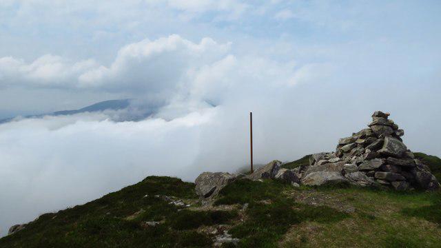 Photo could not load
W0482 : Crohane summit cairn
Colin Park
Hill facts and local notes
Classifications
Elevation
655m
2,149 ft
Prominence
393m
Coordinates
51.9911, -9.3842
W049829
OS Map
79
At the Summit
The summit boasts a sizeable stone cairn and a triangulation pillar, perfect for a selfie to showcase your achievement. Just remember to share the view, not just your face!
Terrain & Geology
The mountain features a mix of sedimentary and volcanic rocks, primarily schist and quartzite, which create stunning rocky outcrops and dramatic landscapes. Impressively weathered, they tell tales of ancient geological processes.
Views & Scenery
From the summit, you can enjoy spectacular sights of the surrounding valleys, Lough Acoose, and the distant MacGillycuddy's Reeks. Try locating all the lakes; it’s like playing hide and seek with nature.
History & Heritage
Name Origin
An Cruachan translates to 'the round hill,' a fitting name for a summit that rounds out the skyline beautifully.
Historical Significance
The mountain holds cultural significance in local folklore, often regarded as a sacred space during ancient times.
Getting There & Facilities
Check current local access restrictions, parking rules and transport timetables before travelling. These notes do not confirm public access to the summit.
Parking
Lough Acoose car park (limited spaces available). Be sure to arrive early to secure a spot!
Public Transport
The nearest public transport options are quite limited, so consider arranging a lift or checking local bus schedules.
Nearby Facilities
While there are no facilities directly on the mountain, nearby Glenbeigh offers cafes, restaurants, and public toilets to freshen up after your adventure.
Safety Information
Known Hazards
- Loose rocks, wet and slippery surfaces, and sudden changes in weather. Bring a sense of humour too, it's essential!
General Safety Tips
- Check weather conditions before setting out
- Carry appropriate clothing and equipment
- Let someone know your planned route
- Take a map, compass, and GPS device
- Carry emergency supplies: food, water, first aid kit, torch
Hills
Some common questions about the hills answered
Are there group walks up Crohane [An Cruachan]?
Many walkers use Walkmates to join or organise walks with others. You can check for group walks around Crohane [An Cruachan] through the maps
Are there other walkers around Crohane [An Cruachan]?
Activity varies by location and time, but Walkmates lets you see whether others have shared walks or shown interest in this area. Find other people through the walking friends search walking friends for Crohane [An Cruachan] search or of course create your own walk for Crohane [An Cruachan]
Can I organise a walk to Crohane [An Cruachan]?
Yes. If there aren’t any walks listed already, you can create a walk and make it available for others to join.
If you're signed up to Walkmates, you can create a walk to Crohane [An Cruachan].
How do I find a walk up this hill?
There are often multiple ways to walk this hill, depending on experience and route preference. Walkmates helps you explore walks and routes that others have shared.
Can I suggest a new route up Crohane [An Cruachan]?
Yes. You can suggest or create routes to share with others. Walkmates focuses on the social side of walking, so routes are used to help people organise walks and explore areas together, rather than as detailed navigation tools or route libraries.
Other uses really appreciate knowledgeable walkers sharing their routes. Share your favourite route to Crohane [An Cruachan] here
The is an error or something incorrect about this hill. How do I let you know?
We always strive to keep the information on Walkmates as accurate as possible. If you find an error, please let us know through the contact form and we'll aim to correct it as quickly as possible
Community Discussion
Comments
Location
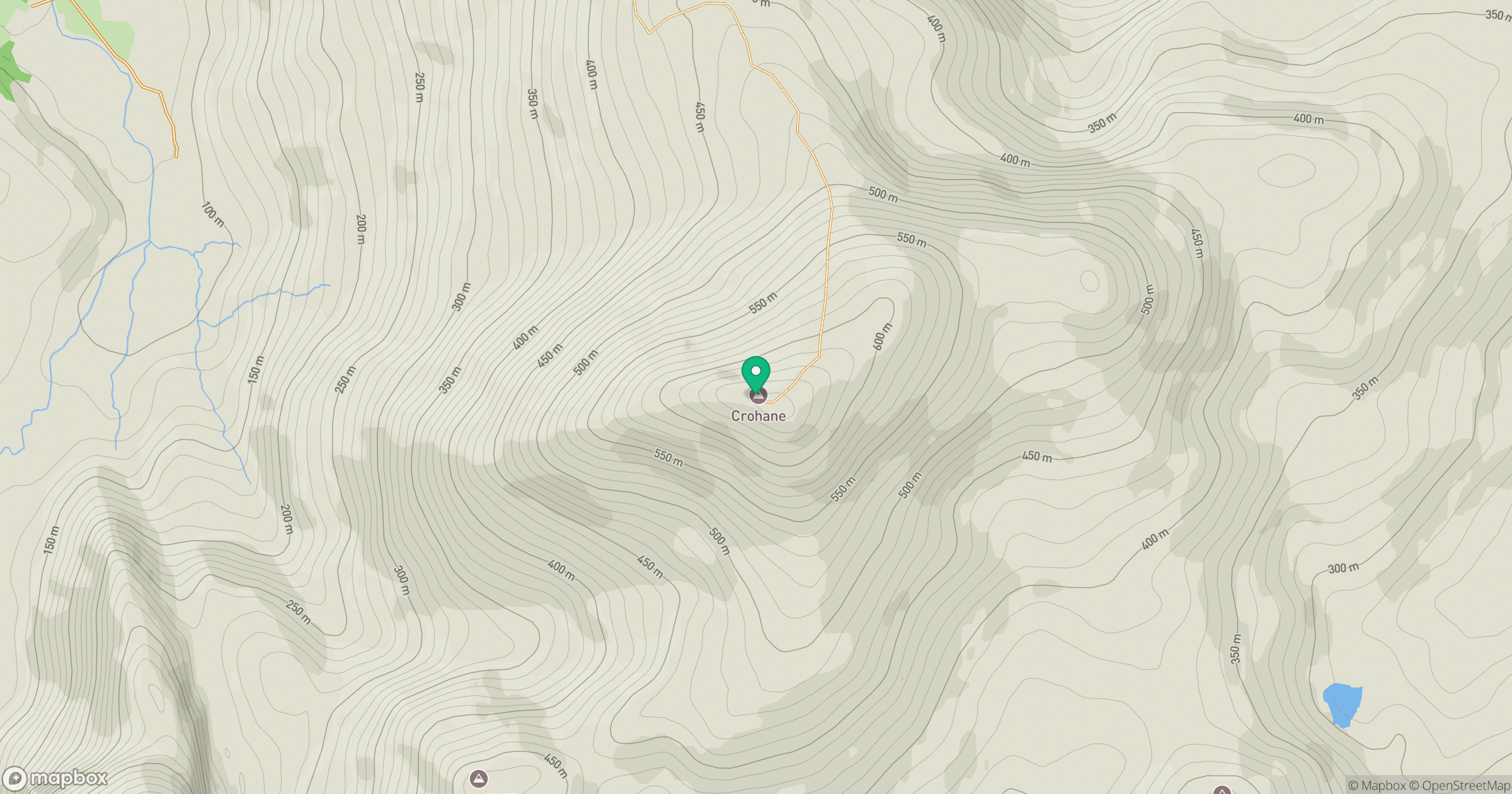
Grid reference: W049829
View on OpenStreetMapOpens a map in a new tab, centred on the hill.
Hills within 30 km
Straight-line distance, not a walking route or confirmation of access.
No comments yet. Be the first.